Do you love smooth asphalt, climbs, and serious challenges? We have great news for you: 6 km of a new road from the village of Šumiac – with an elevation gain of 600 meters, through picturesque forests all the way to Predné sedlo (1,430 m a. s. l.). A quality asphalt surface awaits you (ideal for road bikes), a peaceful natural scenery free of cars and noise, and at the end – a well-deserved rest with refreshments at the Chata pod Kráľovou hoľou mountain hut.
True “die-hard” cyclists can extend their route and rack up additional elevation meters if they start already in Červená Skala or choose the comfortable Telgárt – Šumiac cycling connector, also paved with asphalt.
The forest road above the village of Šumiac is closed to motor traffic with the exception of service vehicles; ride carefully because encounters with motor vehicles are possible.
The maximum permitted speed on the road is 30 km/h, applying to everyone and in every direction.
The exposed alpine terrain and steep character of the routes require strict adherence to the cyclist safety code.
The road is the property of Forests of the Slovak Republic (Lesy Slovenskej Republiky), and it is important to respect the Forest Act.
In the Low Tatras National Park, visitors must follow the rules of conduct according to the visitor regulations.
The surroundings of Kráľova hoľa offer excellent conditions for mountain biking with numerous marked cycling routes in an attractive mountain environment.
The true “cherry on top” is the epic climb to the very summit of Kráľova hoľa. The route from Šumiac is 12 km long with a total elevation gain of 1,040 m, and during the ascent, magnificent panoramic views open up toward the Slanec, Zemplín, and Choč Hills, as well as the Western and High Tatras.
Route surface: lower 6 km – new asphalt surface, upper 6 km – older and damaged asphalt. Mountain bikers can also join the route from other directions – from Telgárt, Pusté Pole, or Liptovská Teplička.
The iconic Horal mountain bike marathon, the Vertikal Kilometer uphill mountain run, or the new uphill time trial on road bikes. The unique environment brings challenges for a wide range of athletes through its variability.
For the ascent, use only marked hiking trails and increase caution when crossing the forest road (heavy cyclist traffic). There is no shelter from bad weather at the summit of Kráľova hoľa. Plan your trip responsibly. Do not forget to bring enough water, a windbreaker, and sun protection – the open ridge tends to be windy and shadowless. You are in the Low Tatras National Park with unique fauna and flora. Please respect the visitor rules.
An iconic peak with unforgettable views Kráľova hoľa (1,946 m a. s. l.) is among the best-known and most visited peaks of the Low Tatras. It is wrapped in legends, praised in folk songs, and its majestic shape is unmistakable from a distance. The ascent to the peak offers a great hiking experience and a reward in the form of panoramic views of the Tatras, Slovak Paradise, Vepor Hills, and other mountain ranges of Slovakia.
The trails are well-marked and manageable for fitter hikers throughout the entire season – from spring to autumn. In winter, the ascent is possible with snowshoes or ski-touring equipment, and in case of hard-packed snow, with crampons and poles. There is a television transmitter at the summit (inaccessible to the public).
The trip can be spiced up by visiting the Chata pod Kráľovou hoľou hut when coming from Šumiac, or by crossing via Skalisko and Kráľova skala when coming from Telgárt. These routes, along with the peak ascent, are connected by an educational trail.
The SNP Heroes’ Trail (Cesta hrdinov SNP) is more than just a hiking route – it is a symbol of the nation, a journey across Slovakia and into oneself. It leads from the Dukla Pass to Devín, measures over 760 km, and carries the memory of the fight for freedom, pride, and perseverance. One of its strongest sections is the ascent to Kráľova hoľa (1,946 m a. s. l.), which most commonly starts from the village of Telgárt (885 m a. s. l.) following the red E8 trail marker. It takes approximately 2.5 to 3 hours depending on fitness and conditions.
Kráľova hoľa offers not only panoramic views but also a deep cultural and historical heritage. The trail continues along the ridge of the Low Tatras across Andrejcová all the way to Čertovica and belongs to the most beautiful sections of the entire SNP trail. Soldiers, partisans, and civilians once walked this path – today hikers, runners, and pilgrims, each with their own reason, but with equal respect for those who went before us. The SNP Heroes’ trail is a test of endurance, a memory, and a cleansing, reminding us that freedom was never a given.
All roads lead to Kráľova hoľa, which offers multiple options and always has something to offer even during repeat visits. You can choose a trail along the ridge of the Low Tatras and the iconic SNP trail, a route with a mountain hut halfway up, a rocky peak overgrown with dwarf pine, a light detour along the road, or quiet, low-traffic paths. Everyone will find the right choice for the moment.
Kráľova hoľa (1,946 m a. s. l.) is also a popular launch point for paragliders. Thanks to its open ridge, significant elevation gain, and stunning views, it ranks among the most beautiful and iconic flying spots in Slovakia.
Thermal conditions especially during spring and summer, a wide launch area, large elevation gain with road access, and views into the heart of Slovakia – these are ideal conditions even for long-distance cross-country flights. Launches are most frequently directed toward the southeast and southwest. Landing zones are located around the villages of Šumiac, Telgárt, or in the meadows of the foothills.
Kráľova hoľa lies within a protected area (NAPANT). In the case of organized flights, it is necessary to respect nature conservation rules, coordinate activities, and monitor current restrictions.
Kráľova hoľa lies within the territory of the Low Tatras National Park – movement outside marked trails or skimo zones is restricted. Respect nature, seasonal closures, and nature conservation rules. There is no shelter from bad weather at the summit. Plan your trip responsibly.
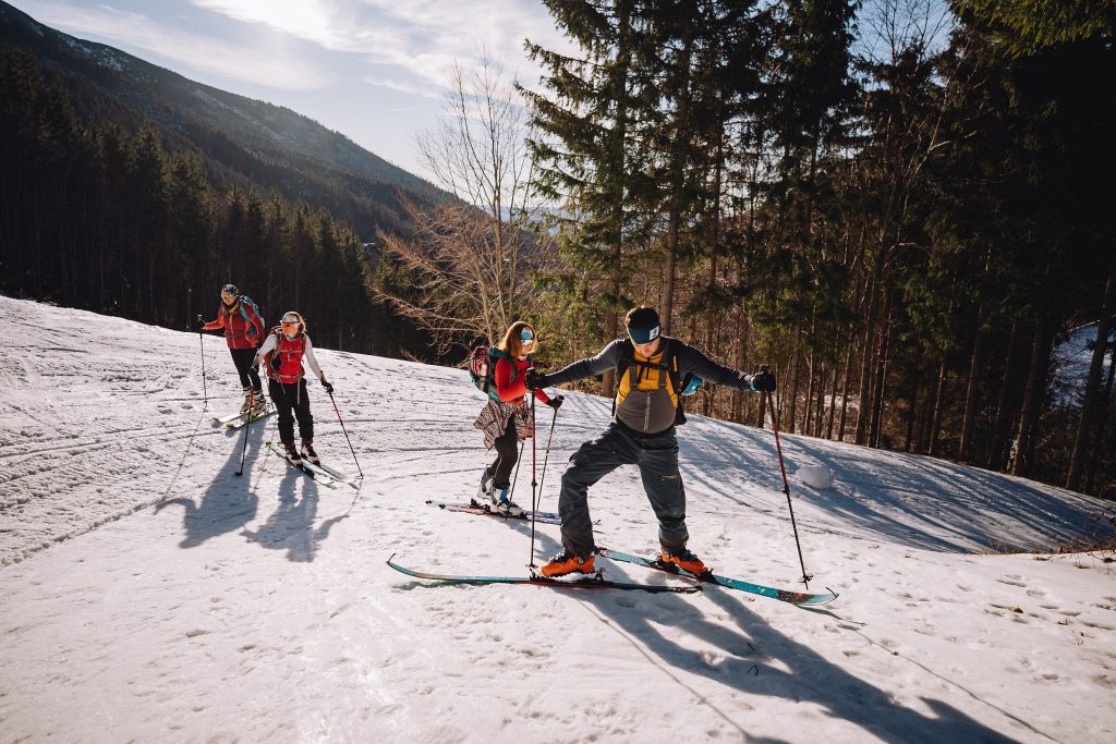
Ski mountaineering on Kráľova hoľa – a winter classic of the Low Tatras. In winter, Kráľova hoľa is a favorite destination for skialpinists from all over Slovakia. Its wide, open slopes and relatively undemanding terrain make it an ideal place for recreational and advanced ski mountaineering. Both the ascent and descent offer magnificent views and an unforgettable experience in the heart of the winter Low Tatras.
Routes mostly follow forest and service roads, leading through open terrain in the upper section. An advantage is the possibility of ascent without avalanche danger, but under extreme conditions, increased caution is necessary – the summit area is exposed to wind and rapid weather changes.
Most frequent ascents:
From Šumiac – the classic and most utilized route (via forest road, approx. 12 km)
From Telgárt or Pusté Pole – for experienced skialpinists
From Liptovská Teplička – a longer but panoramic route
From Pohorelá along the ridge via Andrejcová
Ski touring is permitted in these areas from December 15 to April 30, from one hour after sunrise to one hour before sunset, within 50 meters of the winter pole markings or the marked hiking trail.
The area is bounded on the north and east by the Šumiac – Kráľova hoľa road and the red-marked hiking trail no. 0801 Telgárt – Kráľova hoľa, and on the west by the line of the saddle between Kráľova hoľa and Stredná hoľa – the Vyšné Rovienky ridge.
Important: Remember that you are moving within a national park area – respect nature, avoid disturbing wildlife, and monitor current snow and weather conditions.
Cross-country skiing below Kráľova hoľa – quiet tracks in the heart of nature
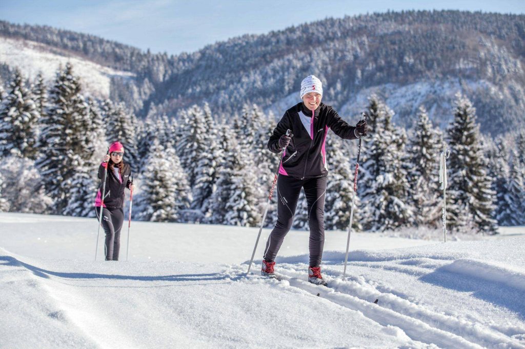
The surroundings of Kráľova hoľa offer a quiet refuge for cross-country skiing enthusiasts in winter as well. Thanks to the gently rolling terrain and open views, recreational cross-country skiers and more experienced athletes alike will find something to enjoy.
Access from Liptovská Teplička or Telgárt – open terrains and forest roads suitable for backcountry cross-country skis.
The trails are not machine-groomed, therefore wider skis (backcountry) and basic terrain orientation skills are recommended. The reward is silence, peace, and views of the winter Low Tatras.
Recommended route: From the village of Šumiac to Predné sedlo (approx. 6 km) on a new smooth asphalt surface covered with snow; ideal for both classical and skating styles, but watch out for the steep elevation gain.

Na našich webových stránkach využívame cookies, aby sme vám zabezpečili čo najlepší zážitok z prezerania webových stránok. Môžete spravovať svoje nastavenia cookies alebo jednoducho všetky prijať.